Oyster Beds and Salt Marshes; Magical Mersea
Type: Walk
Duration: 8h - 1d
Facilities
Routes
- Length of route (miles) - 13.4

To build your own Itinerary, click  next to an item to add it to your Itinerary basket. You will then be able to save, download, or share your itinerary.
Already saved an Itinerary?


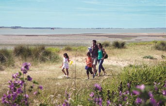
Essex has more islands than any other English county, and they are special too. These are England’s most important salt marshes. Canvey, Osea, Foulness and many more.
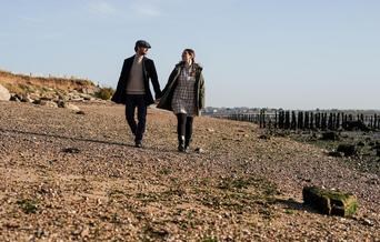
Mersea Island is arguably the most beautiful; a combination of wild and urban magic. Somewhere to see porpoises and migrating ospreys in spring, or red squirrels all year round. Good food, drink and hospitality – everything from local caught oysters and vineyard wine, to pubs and dining.
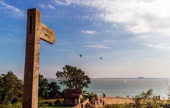
The island is connected to land by a mythical causeway known as the 'Strood' – believed to be one of the only Anglo-Saxon land bridges in England. Mersea can be navigated by sail or kayak, but is probably best seen from the land. The terra visitor gets isolated sea and land views, as well as easy access to lazy deckchairs, historic buildings and refreshments.
The first stretch, along the wilds of Mersea beach, was a stunning vista of yachts, dilapidated houseboats, and the 'monkey steps' where, in the 18th and 19th centuries, officials would guard against smugglers.
Forget the traffic and forget the noise. The gently rolling landscape of Essex, sprinkled with rivers and lit by constantly changing East Anglian skies, miles of country lanes, hidden byways, bridleways and public footpaths is best explored by walking or cycling.
*Please check for any temporary path closures and tidal conditions before setting out

10 bay covered Driving Range for all weather practice - open to everyone. This undercover…
For fishing holidays in Essex that will leave you hooked, choose Waldegraves Holiday…
Get ready for fun with our 9-hole course FootGolf course in Essex. The latest sporting…

Ratings
Powered By
![]()
© Visit Essex 2026. All Rights Reserved